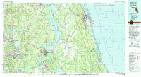
1981 Map of Saint Augustine
USGS Topo · Published 1982About this map
The St Johns River dominates the central corridor of this 1981 survey, serving as a massive waterway that separates the agricultural interior from the coastal settlements of St Augustine. Along its banks, the river connects historical hubs like Palatka and Welaka, while its wide stretches are marked by landmarks like Murphy Island and Federal Point. To the west, the landscape transitions into the heavily managed terrain of the Camp Blanding military installation and the Camp Blanding Wildlife Management Area, featuring a dense concentration of smaller lakes such as Kingsley Lake and Lake Johnson. The eastern edge is defined by the Matanzas River and the Atlantic coastline, where Anastasia Island and Vilano Beach stand between the mainland and the ocean. Inland transportation is anchored by the Seaboard Coast Line railroad, which links smaller farming communities like Hastings, Spuds, and Florahome.
Find a feature on this map
109 named features on this map. Tap any name to fly to it.
Don’t see what you’re looking for? This feature index may not catch every label — zoom into the map to look around manually.
Map Details
Editions of this 1981 Saint Augustine Map
2 editions found
Other maps of this area

1893 · Citra
USGS Topo · 1:62,500

1895 · Citra
USGS Topo · 1:62,500

1912 · Palatka
USGS Topo · 1:48,000

1915 · Palatka
USGS Topo · 1:62,500

1915 · Interlachen
USGS Topo · 1:48,000

1916 · Interlachen
USGS Topo · 1:62,500

1917 · Orange Park
USGS Topo · 1:62,500

1918 · Middleburg
USGS Topo · 1:62,500

1918 · Lawtey
USGS Topo · 1:62,500

1918 · Orange Park
USGS Topo · 1:62,500