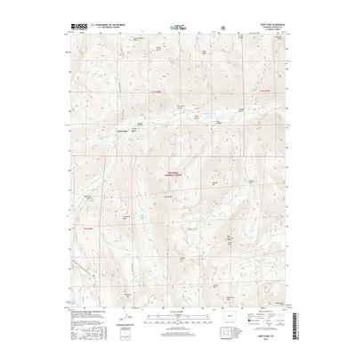
2016 Map of Saint Elmo
USGS Topo · Published 2016About this map
Saint Elmo sits at the heart of this high-elevation landscape within the San Isabel National Forest, where the terrain is defined by steep glacial cirques and prominent summits. The map illustrates a dense concentration of mining-era legacy through numerous gulches and named peaks, including Chrysolite Mtn and Carbonate Mtn, whose names reflect the mineral wealth that once drove local industry. Water resources are prominent, with Chalk Cr and its northern fork draining the high country, fed by alpine bodies such as Grizzly Lake and Pomeroy Lake. Transportation in this modern survey is dominated by recreational and historic paths, specifically the Continental Divide National Scenic Trail which traverses the western ridges, alongside the Poplar Gulch Trail and Pomeroy Lakes Trail. The survey shows the modern configuration of the Sawatch Range, including the southern reaches of the Collegiate Peaks near the Chaffee County line.
Find a feature on this map
41 named features on this map. Tap any name to fly to it.
Don’t see what you’re looking for? This feature index may not catch every label — zoom into the map to look around manually.
Map Details
Editions of this 2016 Saint Elmo Map
This is the sole edition of this map. No revisions or reprints were ever made.
Other maps of this area

1940 · Garfield
USGS Topo · 1:62,500

1945 · Garfield
USGS Topo · 1:62,500

1955 · Buena Vista
USGS Topo · 1:62,500

1955 · Mount Harvard
USGS Topo · 1:62,500

1956 · Poncha Springs
USGS Topo · 1:62,500

1956 · Montrose
USGS Topo · 1:250,000

1959 · Montrose
USGS Topo · 1:250,000

1960 · Montrose
USGS Topo · 1:250,000

1968 · Montrose
USGS Topo · 1:250,000

1982 · Buena Vista West
USGS Topo · 1:24,000