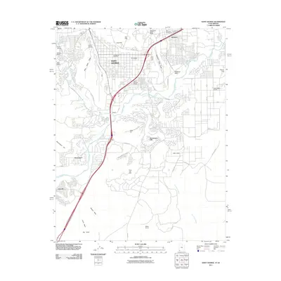
2011 Map of Saint George
USGS Topo · Published 2011About this map
Saint George and its surrounding desert landscapes are captured here at a moment of significant 21st-century growth, where modern residential developments meet the ancient geology of the Colorado Plateau. The Virgin River and Santa Clara River converge near Toniquint, providing a lifeline of greenery that separates the urban core from the agricultural expanses of Washington Fields and Saint George Fields. The town's expansion is physically constrained and defined by dramatic volcanic and sedimentary features, including the basalt-capped Middleton Black Ridge and West Black Ridge, which hem in the city center. This survey documents the transition of the outlying areas, showing established neighborhoods in Bloomington alongside newer suburban reaches in Little Valley. Significant infrastructure, such as the Old FAA Airport and the centrally located Saint George Post Office, mark the civic layout of the regional hub, while the Saint George City Cemetery sits as a permanent record of the community’s heritage near the Red Hills.
Find a feature on this map
57 named features on this map. Tap any name to fly to it.
Don’t see what you’re looking for? This feature index may not catch every label — zoom into the map to look around manually.
Map Details
Editions of this 2011 Saint George Map
This is the sole edition of this map. No revisions or reprints were ever made.
Other maps of this area

1885 · St. George
USGS Topo · 1:250,000

1886 · Mt. Trumbull
USGS Topo · 1:250,000

1891 · St. George
USGS Topo · 1:250,000

1892 · Mt. Trumbull
USGS Topo · 1:250,000

1953 · Cedar City
USGS Topo · 1:250,000

1953 · Grand Canyon
USGS Topo · 1:250,000

1954 · Hurricane Cliffs 2 NW
USGS Topo · 1:24,000

1954 · La Verkin 3 NW
USGS Topo · 1:24,000

1954 · Wolf Hole Mtn. NW
USGS Topo · 1:24,000

1954 · La Verkin 3 SW
USGS Topo · 1:24,000