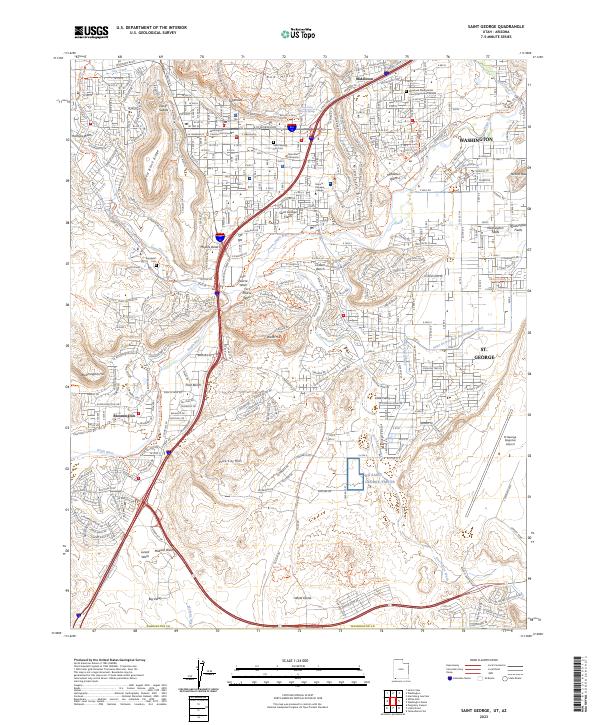
2023 Map of Saint George
USGS Topo · Published 2023About this map
St. George and Washington anchor this 2023 survey of southwest Utah, where the urban expansion of the Sunbelt meets the dramatic geological formations of the Mojave Desert. The map documents a complex landscape of residential growth pushing against historical agricultural zones like Saint George Fields and Washington Fields. High-altitude features such as the Red Hills, West Black Ridge, and Middleton Black Ridge create natural boundaries for the sprawling suburbs of Middleton, Bloomington, and Little Valley. The Virgin River and its tributaries, including Fort Pearce Wash and Halfway Wash, carve through the basin, while significant modern infrastructure like the St George Regional Airport and Dixie State University reflect the area's development as a regional hub. Local history is preserved at the Washington County Court House and within the quiet grounds of the Saint George City Cem and Tonaquint Cem.
Find a feature on this map
91 named features on this map. Tap any name to fly to it.
Don’t see what you’re looking for? This feature index may not catch every label — zoom into the map to look around manually.
Map Details
Editions of this 2023 Saint George Map
This is the sole edition of this map. No revisions or reprints were ever made.
Other maps of this area

1885 · St. George
USGS Topo · 1:250,000

1886 · Mt. Trumbull
USGS Topo · 1:250,000

1891 · St. George
USGS Topo · 1:250,000

1892 · Mt. Trumbull
USGS Topo · 1:250,000

1953 · Cedar City
USGS Topo · 1:250,000

1953 · Grand Canyon
USGS Topo · 1:250,000

1954 · Hurricane Cliffs 2 NW
USGS Topo · 1:24,000

1954 · La Verkin 3 NW
USGS Topo · 1:24,000

1954 · Wolf Hole Mtn. NW
USGS Topo · 1:24,000

1954 · La Verkin 3 SW
USGS Topo · 1:24,000