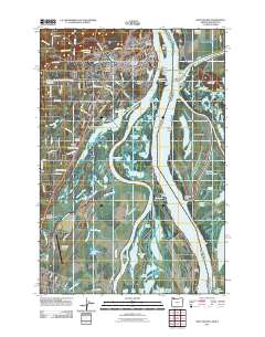
2011 Map of Saint Helens
USGS Topo · Published 2011About this map
Saint Helens and its residential extensions at Columbia Heights and West Saint Helens overlook the massive confluence of the Columbia River and the Lewis River in this detailed 2011 survey. The landscape is defined by the shifting hydrology of the river bottomlands, where Bachelor Island and Coon Island separate complex water bodies like Sturgeon Lake and Widgeon Lake from the main navigation channels. Historically significant sites for genealogists include the Independent Order of Odd Fellows Cemetery and the Lutheran Cemetery near the settlement of Warren.
Find a feature on this map
131 named features on this map. Tap any name to fly to it.
Don’t see what you’re looking for? This feature index may not catch every label — zoom into the map to look around manually.
Map Details
Editions of this 2011 Saint Helens Map
This is the sole edition of this map. No revisions or reprints were ever made.
Other maps of this area

1897 · Portland
USGS Topo · 1:62,500

1905 · Portland
USGS Topo · 1:62,500

1915 · Hillsboro
USGS Topo · 1:62,500

1918 · Hillsboro
USGS Topo · 1:62,500

1922 · St. Helens
USGS Topo · 1:62,500

1940 · Hillsboro
USGS Topo · 1:62,500

1940 · Portland
USGS Topo · 1:62,500

1940 · La Center
USGS Topo · 1:62,500

1941 · St Helens
USGS Topo · 1:62,500

1943 · St Helens
USGS Topo · 1:62,500