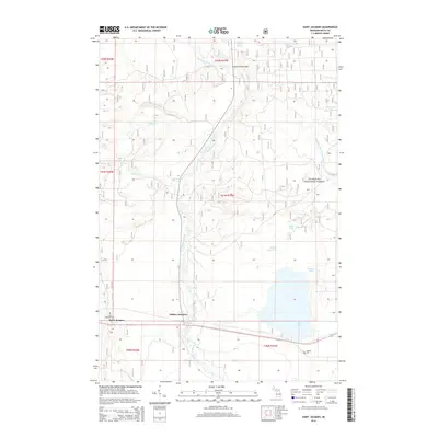
2014 Map of Saint Jacques
USGS Topo · Published 2014About this map
The Sturgeon River serves as the central geographic axis of this Delta County landscape, flowing southward through the Hiawatha National Forest toward the northern shores of Big Bay de Noc. The settlement of Saint Jacques and the transport node at Nahma Junction anchor the southern portion of the map, illustrating the intersection of local roads and the regional waterway. Notable for genealogists, the Saint Jacques Cem and Isabella Cem are clearly marked, providing precise locations for family history research.
Find a feature on this map
26 named features on this map. Tap any name to fly to it.
Don’t see what you’re looking for? This feature index may not catch every label — zoom into the map to look around manually.
Map Details
Editions of this 2014 Saint Jacques Map
This is the sole edition of this map. No revisions or reprints were ever made.
Other maps of this area

1932 · Rapid River NE
USGS Topo · 1:31,680

1932 · Garden NW and SW
USGS Topo · 1:31,680

1932 · Skeels Lake SE
USGS Topo · 1:31,680

1932 · Garden SE
USGS Topo · 1:31,680

1932 · Trenary SE
USGS Topo · 1:31,680

1932 · Rapid River SE
USGS Topo · 1:31,680

1932 · Skeels Lake NW and SW
USGS Topo · 1:31,680

1932 · Garden NE
USGS Topo · 1:31,680

1954 · Escanaba
USGS Topo · 1:250,000

1957 · Escanaba
USGS Topo · 1:250,000