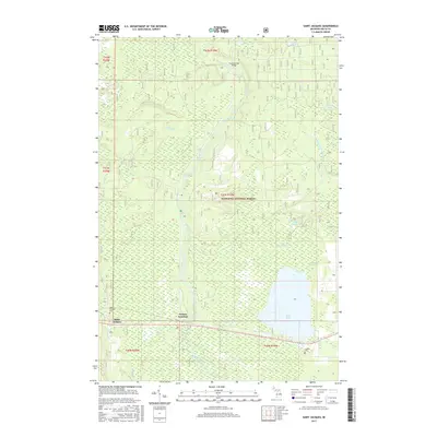
2017 Map of Saint Jacques
USGS Topo · Published 2017About this map
The Sturgeon River flows through the heart of this Upper Peninsula landscape, carving a path through the extensive wetlands and woodlands of the Hiawatha National Forest. This 2017 survey captures the intersection of industrial transport and natural preservation in Delta County, where the southern settlement of Nahma Junction serves as a gateway to the dense timberlands. The terrain is characterized by a low-lying hydrological network, featuring the sprawling Moss Lake and smaller bodies like Little Moss Lake and Bourgois Lake.
Find a feature on this map
26 named features on this map. Tap any name to fly to it.
Don’t see what you’re looking for? This feature index may not catch every label — zoom into the map to look around manually.
Map Details
Editions of this 2017 Saint Jacques Map
This is the sole edition of this map. No revisions or reprints were ever made.
Other maps of this area

1932 · Rapid River NE
USGS Topo · 1:31,680

1932 · Garden NW and SW
USGS Topo · 1:31,680

1932 · Skeels Lake SE
USGS Topo · 1:31,680

1932 · Garden SE
USGS Topo · 1:31,680

1932 · Trenary SE
USGS Topo · 1:31,680

1932 · Rapid River SE
USGS Topo · 1:31,680

1932 · Skeels Lake NW and SW
USGS Topo · 1:31,680

1932 · Garden NE
USGS Topo · 1:31,680

1954 · Escanaba
USGS Topo · 1:250,000

1957 · Escanaba
USGS Topo · 1:250,000