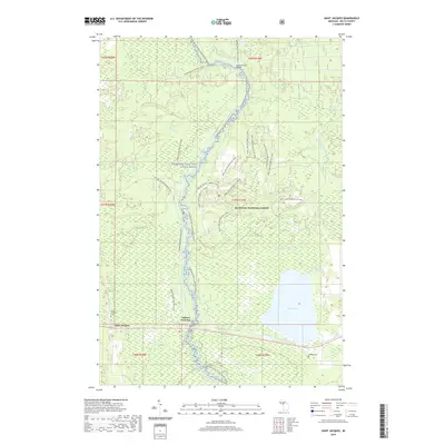
2019 Map of Saint Jacques
USGS Topo · Published 2019About this map
Saint Jacques and Nahma Junction anchor this Delta County landscape, where the Sturgeon River carves a path through the southern reaches of the Hiawatha National Forest. The geography is defined by a dense network of water and wetlands, from the expansive Moss Lake and its associated Little Moss Lake to the spring-fed Germaine Cr. The map reveals a legacy of transit and recreation, preserving the routes of the Nahma Grade Sno-Mo (Snow) and the Moss Lake Motorcycle Trail. Local heritage is marked by quiet landmarks like the Fourteenmile Bridge and two distinct burial grounds, Saint Jacques Cem and Isabella Cem, located near the southern settlements. This area of the Sturgeon Wild and Scenic River remains characterized by its complex hydrography, including features like Cache Lake and the Sturgeon River Canoe Route.
Find a feature on this map
30 named features on this map. Tap any name to fly to it.
Don’t see what you’re looking for? This feature index may not catch every label — zoom into the map to look around manually.
Map Details
Editions of this 2019 Saint Jacques Map
This is the sole edition of this map. No revisions or reprints were ever made.
Other maps of this area

1932 · Rapid River NE
USGS Topo · 1:31,680

1932 · Garden NW and SW
USGS Topo · 1:31,680

1932 · Skeels Lake SE
USGS Topo · 1:31,680

1932 · Garden SE
USGS Topo · 1:31,680

1932 · Trenary SE
USGS Topo · 1:31,680

1932 · Rapid River SE
USGS Topo · 1:31,680

1932 · Skeels Lake NW and SW
USGS Topo · 1:31,680

1932 · Garden NE
USGS Topo · 1:31,680

1954 · Escanaba
USGS Topo · 1:250,000

1957 · Escanaba
USGS Topo · 1:250,000