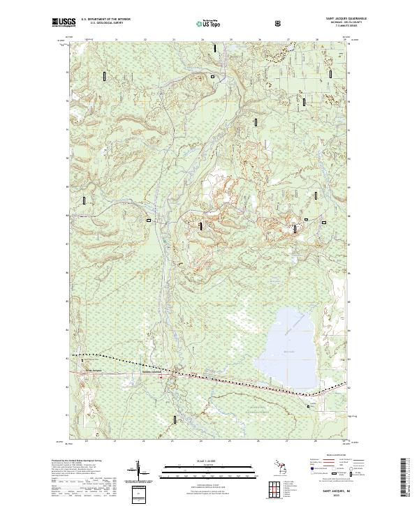
2023 Map of Saint Jacques
USGS Topo · Published 2023About this map
The Sturgeon Wild and Scenic River forms a central ecological corridor through this portion of the Hiawatha National Forest in Delta County. The settlement at Saint Jacques and the nearby Nahma Junction represent the primary points of habitation, situated near the western edge of a landscape defined by glacial lakes and winding waterways. This 2023 edition documents the modern road and trail network, including the Nahma Grade Sno-mo Trl, which follows a path likely rooted in the region's logging history.
Find a feature on this map
29 named features on this map. Tap any name to fly to it.
Don’t see what you’re looking for? This feature index may not catch every label — zoom into the map to look around manually.
Map Details
Editions of this 2023 Saint Jacques Map
This is the sole edition of this map. No revisions or reprints were ever made.
Other maps of this area

1932 · Rapid River NE
USGS Topo · 1:31,680

1932 · Garden NW and SW
USGS Topo · 1:31,680

1932 · Skeels Lake SE
USGS Topo · 1:31,680

1932 · Garden SE
USGS Topo · 1:31,680

1932 · Trenary SE
USGS Topo · 1:31,680

1932 · Rapid River SE
USGS Topo · 1:31,680

1932 · Skeels Lake NW and SW
USGS Topo · 1:31,680

1932 · Garden NE
USGS Topo · 1:31,680

1954 · Escanaba
USGS Topo · 1:250,000

1957 · Escanaba
USGS Topo · 1:250,000