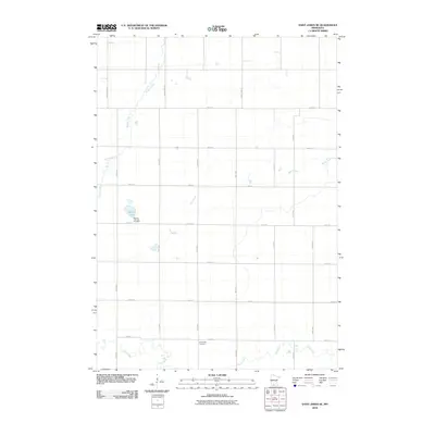
2010 Map of Saint James SE
USGS Topo · Published 2010About this map
Waverly Lutheran Cemetery and Round Lake anchor the northwestern portion of this landscape, reflecting the settled agricultural patterns of Martin County at the start of the 21st century. The map depicts a highly organized township-and-range grid system, where section lines are traced by local roads such as 250th St and 130th Ave. This rectilinear geometry is only interrupted by the natural wandering paths of Willow Creek, Mink Creek, and Elm Creek. Further south, the North Star Cemetery sits near the banks of Elm Creek, providing a focal point for genealogical interest. This survey illustrates a quiet, rural interior dominated by family farms and local transit corridors like County Hwy-27 and County Hwy-122, preserved here just as modern digital mapping standards were being established.
Find a feature on this map
23 named features on this map. Tap any name to fly to it.
Don’t see what you’re looking for? This feature index may not catch every label — zoom into the map to look around manually.
Map Details
Editions of this 2010 Saint James SE Map
This is the sole edition of this map. No revisions or reprints were ever made.
Other maps of this area

1954 · Fairmont
USGS Topo · 1:250,000

1958 · Fairmont
USGS Topo · 1:250,000

1967 · Truman
USGS Topo · 1:24,000

1967 · Lewisville
USGS Topo · 1:24,000

1967 · Fairmont
USGS Topo · 1:24,000

1970 · St James SE
USGS Topo · 1:24,000
1970 · St James West
USGS Topo · 1:24,000

1970 · Trimont
USGS Topo · 1:24,000
1970 · St James East
USGS Topo · 1:24,000

1970 · Welcome
USGS Topo · 1:24,000