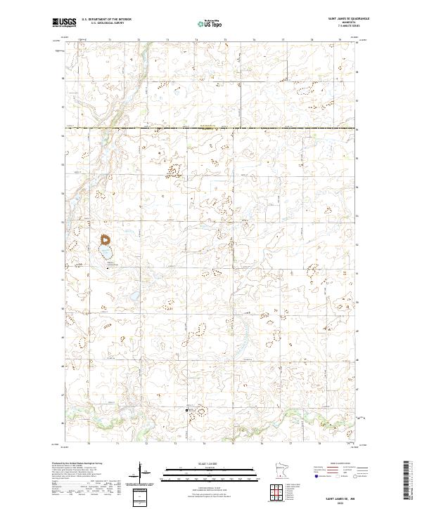
2022 Map of Saint James SE
USGS Topo · Published 2022About this map
The agricultural boundary between Watonwan and Martin counties forms the central axis of this landscape, where the prairie gives way to a network of creeks and drainage ditches. The area is anchored by Round Lake, a prominent water body situated near the Waverly Lutheran Cem. This cemetery, along with North Star Cem to the south, serves as a primary marker for local genealogical research in this rural expanse. Water management is a defining characteristic of the terrain, visible through the natural meanders of Mink Cr and Willow Cr, as well as the engineered path of Judicial Ditch Number Sixty. The map details a precise grid of township and range lines, including t104n r31w, which organize the farmsteads and rural routes that have sustained this portion of southern Minnesota for generations.
Find a feature on this map
35 named features on this map. Tap any name to fly to it.
Don’t see what you’re looking for? This feature index may not catch every label — zoom into the map to look around manually.
Map Details
Editions of this 2022 Saint James SE Map
This is the sole edition of this map. No revisions or reprints were ever made.
Other maps of this area

1954 · Fairmont
USGS Topo · 1:250,000

1958 · Fairmont
USGS Topo · 1:250,000

1967 · Truman
USGS Topo · 1:24,000

1967 · Lewisville
USGS Topo · 1:24,000

1967 · Fairmont
USGS Topo · 1:24,000

1970 · St James SE
USGS Topo · 1:24,000
1970 · St James West
USGS Topo · 1:24,000

1970 · Trimont
USGS Topo · 1:24,000
1970 · St James East
USGS Topo · 1:24,000

1970 · Welcome
USGS Topo · 1:24,000