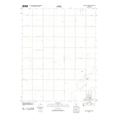
2009 Map of Saint John North
USGS Topo · Published 2009About this map
Saint John anchors the southeastern corner of this central Kansas landscape, where the town's grid meets the vast agricultural sections of Stafford County. The terrain is defined by the winding paths of several waterways, most notably Rattlesnake Creek and Wild Horse Creek, which carve subtle paths through the prairie. In the early 21st century, the area maintains a strictly rural character, organized by a precise network of section roads like NW 110th St and NW 30th Ave. Just north of the town center, Schulz Field stands as a local landmark, while smaller tributaries such as Little Wild Horse Creek and Bear Creek suggest the natural drainage patterns that have dictated local land use for generations. This survey provides a clear look at the spatial relationship between the county seat's outskirts and the surrounding farming heritage.
Find a feature on this map
20 named features on this map. Tap any name to fly to it.
Don’t see what you’re looking for? This feature index may not catch every label — zoom into the map to look around manually.
Map Details
Editions of this 2009 Saint John North Map
This is the sole edition of this map. No revisions or reprints were ever made.
Other maps of this area

1891 · Great Bend
USGS Topo · 1:125,000

1892 · Pratt
USGS Topo · 1:125,000

1893 · Great Bend
USGS Topo · 1:125,000

1894 · Pratt
USGS Topo · 1:125,000

1955 · Great Bend
USGS Topo · 1:250,000

1955 · Pratt
USGS Topo · 1:250,000

1957 · Great Bend
USGS Topo · 1:250,000

1958 · Great Bend
USGS Topo · 1:250,000

1959 · Pratt
USGS Topo · 1:250,000
1969 · Radium
USGS Topo · 1:24,000