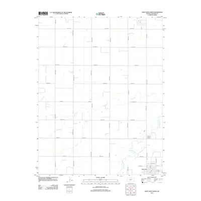
2012 Map of Saint John North
USGS Topo · Published 2012About this map
Saint John anchors the southeastern corner of this Stafford County landscape, where the town grid meets a vast agricultural expanse defined by a geometric section-line road network. The terrain is characterized by the meandering courses of Rattlesnake Cr and Wild Horse Cr, which break the rigid symmetry of the plains. These riparian corridors, along with Bear Cr and Little Wild Horse Cr, represent the vital drainage systems of the region. Local transit and property boundaries are traced along established routes like Eden Valley Rd and Zook Rd, reflecting the long-standing agrarian organization of central Kansas. The map offers a clear view of the rural-to-urban transition on the northern edge of the county seat, documenting the intersection of natural watercourses and human engineering.
Find a feature on this map
29 named features on this map. Tap any name to fly to it.
Don’t see what you’re looking for? This feature index may not catch every label — zoom into the map to look around manually.
Map Details
Editions of this 2012 Saint John North Map
This is the sole edition of this map. No revisions or reprints were ever made.
Other maps of this area

1891 · Great Bend
USGS Topo · 1:125,000

1892 · Pratt
USGS Topo · 1:125,000

1893 · Great Bend
USGS Topo · 1:125,000

1894 · Pratt
USGS Topo · 1:125,000

1955 · Great Bend
USGS Topo · 1:250,000

1955 · Pratt
USGS Topo · 1:250,000

1957 · Great Bend
USGS Topo · 1:250,000

1958 · Great Bend
USGS Topo · 1:250,000

1959 · Pratt
USGS Topo · 1:250,000
1969 · Radium
USGS Topo · 1:24,000