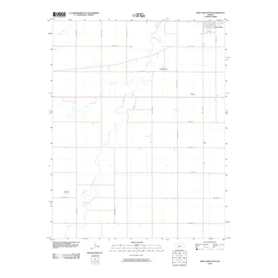
2009 Map of Saint John South
USGS Topo · Published 2009About this map
Rattlesnake Creek meanders through the heart of this Stafford County landscape, defining the local drainage patterns alongside Bear Creek and Spring Creek. The southern outskirts of Saint John anchor the northeastern corner of the map, where the street grid of S Prairie St and S West St gives way to a sprawling network of section-line roads. This area reflects a classic Great Plains agricultural and industrial interface, prominently featuring the Rattlesnake Southeast Oil Field in the northern half of the quadrangle.
Find a feature on this map
26 named features on this map. Tap any name to fly to it.
Don’t see what you’re looking for? This feature index may not catch every label — zoom into the map to look around manually.
Map Details
Editions of this 2009 Saint John South Map
This is the sole edition of this map. No revisions or reprints were ever made.
Other maps of this area

1891 · Great Bend
USGS Topo · 1:125,000

1892 · Pratt
USGS Topo · 1:125,000

1893 · Great Bend
USGS Topo · 1:125,000

1894 · Pratt
USGS Topo · 1:125,000

1955 · Great Bend
USGS Topo · 1:250,000

1955 · Pratt
USGS Topo · 1:250,000

1957 · Great Bend
USGS Topo · 1:250,000

1958 · Great Bend
USGS Topo · 1:250,000

1959 · Pratt
USGS Topo · 1:250,000
1971 · Hudson
USGS Topo · 1:24,000