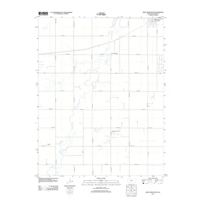
2012 Map of Saint John South
USGS Topo · Published 2012About this map
Rattlesnake Cr winds through the agricultural landscape south of St. John, defining the local drainage alongside Spring Cr and Bear Cr. This Stafford County terrain is marked by a rigorous section-line road grid, reflecting its orderly development for farming and energy extraction. The presence of the Rattlesnake Southeast Oil Field and the Rattlesnake Southwest Oil Field illustrates the significant role of the petroleum industry in this rural corridor. Genealogists and local historians will find value in the location of the Independent Order of Odd Fellows Lodge Number 539 in the northern portion of the map, as well as rural burial sites including Martin Cem and Neelands Cem.
Find a feature on this map
31 named features on this map. Tap any name to fly to it.
Don’t see what you’re looking for? This feature index may not catch every label — zoom into the map to look around manually.
Map Details
Editions of this 2012 Saint John South Map
This is the sole edition of this map. No revisions or reprints were ever made.
Other maps of this area

1891 · Great Bend
USGS Topo · 1:125,000

1892 · Pratt
USGS Topo · 1:125,000

1893 · Great Bend
USGS Topo · 1:125,000

1894 · Pratt
USGS Topo · 1:125,000

1955 · Great Bend
USGS Topo · 1:250,000

1955 · Pratt
USGS Topo · 1:250,000

1957 · Great Bend
USGS Topo · 1:250,000

1958 · Great Bend
USGS Topo · 1:250,000

1959 · Pratt
USGS Topo · 1:250,000
1971 · Hudson
USGS Topo · 1:24,000