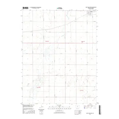
2015 Map of Saint John South
USGS Topo · Published 2015About this map
St. John anchors the northern boundary of this survey, where the street grid transitions into the sprawling agricultural sections of Stafford County. The landscape is defined by the winding course of Rattlesnake Cr, which meanders across the territory alongside smaller tributaries like Bear Cr. This area preserves significant local heritage markers, including the Neelands Cem in the southwest and Martin Cem to the east. A precise network of section-line roads, such as Eden Valley Rd and NW 40th Ave, organizes the prairie, illustrating the enduring influence of the Public Land Survey System on Kansas settlement patterns. The map highlights the interplay between the semi-arid watercourses and the high-density farming typical of the region in the early twenty-first century.
Find a feature on this map
31 named features on this map. Tap any name to fly to it.
Don’t see what you’re looking for? This feature index may not catch every label — zoom into the map to look around manually.
Map Details
Editions of this 2015 Saint John South Map
This is the sole edition of this map. No revisions or reprints were ever made.
Other maps of this area

1891 · Great Bend
USGS Topo · 1:125,000

1892 · Pratt
USGS Topo · 1:125,000

1893 · Great Bend
USGS Topo · 1:125,000

1894 · Pratt
USGS Topo · 1:125,000

1955 · Great Bend
USGS Topo · 1:250,000

1955 · Pratt
USGS Topo · 1:250,000

1957 · Great Bend
USGS Topo · 1:250,000

1958 · Great Bend
USGS Topo · 1:250,000

1959 · Pratt
USGS Topo · 1:250,000
1971 · Hudson
USGS Topo · 1:24,000