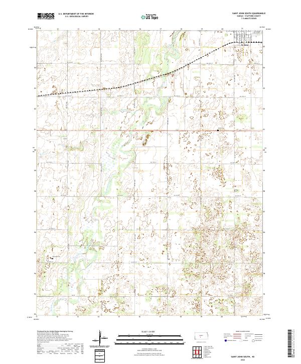
2022 Map of Saint John South
USGS Topo · Published 2022About this map
St. John anchors the northern edge of this agricultural landscape, where the town's street grid—including S Main St and S Broadway St—transitions into the vast sections of the Kansas plains. The terrain is defined by the winding course of Rattlesnake Cr, which meanders through the central and southern portions of the sheet, joined by smaller tributaries like Spring Cr and Bear Cr. These waterways create complex drainage patterns across the prairie, influencing the placement of rural infrastructure.
Find a feature on this map
38 named features on this map. Tap any name to fly to it.
Don’t see what you’re looking for? This feature index may not catch every label — zoom into the map to look around manually.
Map Details
Editions of this 2022 Saint John South Map
This is the sole edition of this map. No revisions or reprints were ever made.
Other maps of this area

1891 · Great Bend
USGS Topo · 1:125,000

1892 · Pratt
USGS Topo · 1:125,000

1893 · Great Bend
USGS Topo · 1:125,000

1894 · Pratt
USGS Topo · 1:125,000

1955 · Great Bend
USGS Topo · 1:250,000

1955 · Pratt
USGS Topo · 1:250,000

1957 · Great Bend
USGS Topo · 1:250,000

1958 · Great Bend
USGS Topo · 1:250,000

1959 · Pratt
USGS Topo · 1:250,000
1971 · Hudson
USGS Topo · 1:24,000