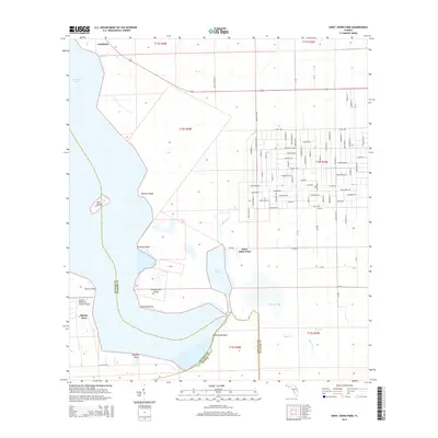
2015 Map of Saint Johns Park
USGS Topo · Published 2015About this map
Crescent Lake and its intricate network of wetlands dominate this portion of the Florida interior, where the boundaries of Flagler, Putnam, and Volusia counties meet. The settlement of Saint Johns Park serves as a focal point, characterized by a grid of streets with botanical names like Mahogany Blvd, Sabal Palm St, and Satinwood ST. This landscape is defined by the transition from open water to marshy inlets, featuring distinctive landforms such as Grimsley Neck and Bear Island.
Find a feature on this map
99 named features on this map. Tap any name to fly to it.
Don’t see what you’re looking for? This feature index may not catch every label — zoom into the map to look around manually.
Map Details
Editions of this 2015 Saint Johns Park Map
This is the sole edition of this map. No revisions or reprints were ever made.
Other maps of this area

1912 · Palatka
USGS Topo · 1:48,000

1915 · Palatka
USGS Topo · 1:62,500

1937 · Dinner Island
USGS Topo · 1:48,000

1943 · Dinner Island
USGS Topo · 1:62,500

1944 · Dinner Island
USGS Topo · 1:62,500

1954 · Daytona Beach
USGS Topo · 1:250,000
1957 · Espanola
USGS Topo · 1:24,000

1958 · Daytona Beach
USGS Topo · 1:250,000

1964 · Daytona Beach
USGS Topo · 1:250,000
1968 · San Mateo
USGS Topo · 1:24,000