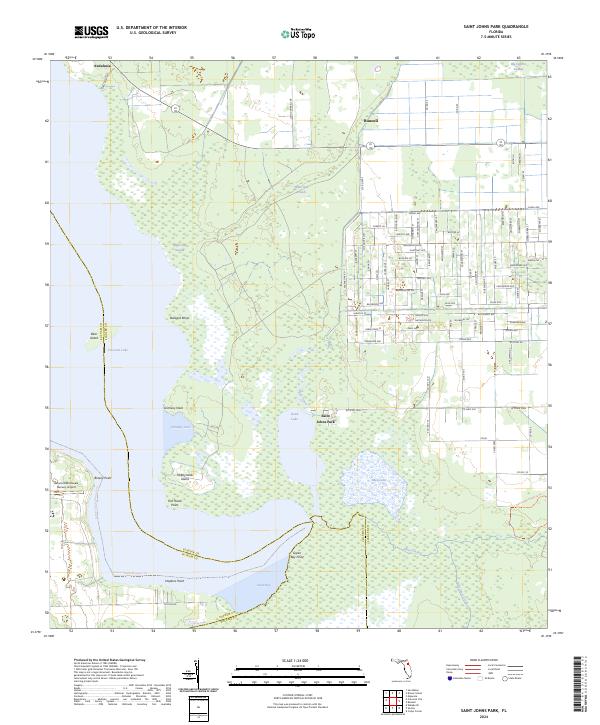
2024 Map of Saint Johns Park
USGS Topo · Published 2024About this map
Crescent Lake and Dead Lake dominate this coastal Florida landscape, where the convergence of Flagler, Putnam, and Volusia counties creates a complex network of waterways and wetlands. The settlement of Saint Johns Park sits at the heart of this aquatic geography, positioned between the expansive waters of Dead Lake and the dense reaches of White Oak Swamp. To the north, the community of Bunnell is defined by an orderly grid of residential streets with botanical names like Mahogany Blvd and Satinwood St. The map illustrates a region where land use is dictated by the water, featuring points and necks such as Grimsley Neck and Fish Hawk Point. Conservation and recreation are represented by the Haw Creek Preserve Trl, while the Skinners Wholesale Nursery Airport highlights the specialized agricultural and logistical operations common to this part of the Florida interior.
Find a feature on this map
103 named features on this map. Tap any name to fly to it.
Don’t see what you’re looking for? This feature index may not catch every label — zoom into the map to look around manually.
Map Details
Editions of this 2024 Saint Johns Park Map
This is the sole edition of this map. No revisions or reprints were ever made.
Other maps of this area

1912 · Palatka
USGS Topo · 1:48,000

1915 · Palatka
USGS Topo · 1:62,500

1937 · Dinner Island
USGS Topo · 1:48,000

1943 · Dinner Island
USGS Topo · 1:62,500

1944 · Dinner Island
USGS Topo · 1:62,500

1954 · Daytona Beach
USGS Topo · 1:250,000
1957 · Espanola
USGS Topo · 1:24,000

1958 · Daytona Beach
USGS Topo · 1:250,000

1964 · Daytona Beach
USGS Topo · 1:250,000
1968 · San Mateo
USGS Topo · 1:24,000