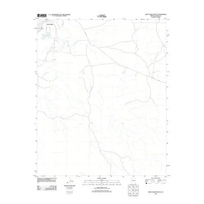
2011 Map of Saint Johns South
USGS Topo · Published 2011About this map
Saint Johns occupies the northwest corner of this landscape, serving as a hub where the Little Colorado River winds through the high desert terrain. The river's path is the primary geographical anchor, supported by water features like the Little Reservoir and the more remote Henry Platt Springs. The road network reflects a rural ranching character, defined by long stretches of Jackalope Rd and several county routes that traverse the open land. This 2011 survey captures the area as it balances small-town Arizona life with the surrounding undeveloped space, showing how infrastructure like Sacramento Ln and Co Rd 6355 connects the central settlement to the broader reaches of Apache County. The map provides a clear view of the drainage patterns and desert hydrology that dictate the settlement patterns of this region.
Find a feature on this map
9 named features on this map. Tap any name to fly to it.
Don’t see what you’re looking for? This feature index may not catch every label — zoom into the map to look around manually.
Map Details
Editions of this 2011 Saint Johns South Map
This is the sole edition of this map. No revisions or reprints were ever made.
Other maps of this area

1886 · St Johns
USGS Topo · 1:250,000

1892 · St Johns
USGS Topo · 1:250,000

1954 · Saint Johns
USGS Topo · 1:250,000

1955 · Wolford Springs 3 SW
USGS Topo · 1:24,000

1957 · Saint Johns
USGS Topo · 1:250,000

1958 · Saint Johns
USGS Topo · 1:250,000

1962 · Saint Johns
USGS Topo · 1:250,000

1971 · Mesa Parada NW
USGS Topo · 1:24,000
1971 · Lyman Lake SW
USGS Topo · 1:24,000
1971 · Voigt Ranch
USGS Topo · 1:24,000