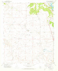
1971 Map of Lyman Lake SW
USGS Topo · Published 1973About this map
The Colorado River corridor south of St. Johns defines this landscape, where the waters of Lyman Lake meet the high desert plains of Apache County. This 1971 survey captures a rural landscape transitioning between ranching traditions and new public recreation at Lyman Lake State Park. Traces of early regional settlement are evident in family-named landmarks such as Hayrock Ranch and Wiltbank Spring, while a small Cem near the river provides a point of interest for genealogists tracking the area's pioneering inhabitants.
Find a feature on this map
32 named features on this map. Tap any name to fly to it.
Don’t see what you’re looking for? This feature index may not catch every label — zoom into the map to look around manually.
Map Details
Editions of this 1971 Lyman Lake SW Map
This is the sole edition of this map. No revisions or reprints were ever made.
Other maps of this area

1886 · St Johns
USGS Topo · 1:250,000

1892 · St Johns
USGS Topo · 1:250,000

1954 · Saint Johns
USGS Topo · 1:250,000

1957 · Saint Johns
USGS Topo · 1:250,000

1958 · Saint Johns
USGS Topo · 1:250,000

1962 · Saint Johns
USGS Topo · 1:250,000

1968 · Springerville NW
USGS Topo · 1:24,000

1969 · Whiting Knoll
USGS Topo · 1:24,000
1969 · Springerville
USGS Topo · 1:24,000
1971 · Cerro Hueco
USGS Topo · 1:24,000