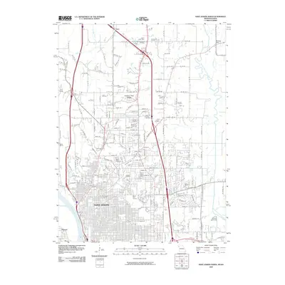
2009 Map of Saint Joseph North
USGS Topo · Published 2009About this map
Saint Joseph occupies the heart of this Missouri landscape, its urban grid extending toward the Missouri River and eastward into sprawling residential developments. This 2009 survey reveals a city deeply connected to its past through numerous memorial sites, including the prominent Mount Mora Cemetery and Mount Auburn Cemetery. To the north, the transition from city to countryside is marked by Country Club Village and the military grounds of Camp Geiger. The topography is defined by the winding paths of the One Hundred and Two River and Long Branch, which carve through the terrain near Avenue City. Infrastructure such as the Water Works and the Moila Golf Course reflect the long-standing civic and recreational development of the Buchanan County seat during the early 21st century.
Find a feature on this map
192 named features on this map. Tap any name to fly to it.
Don’t see what you’re looking for? This feature index may not catch every label — zoom into the map to look around manually.
Map Details
Editions of this 2009 Saint Joseph North Map
This is the sole edition of this map. No revisions or reprints were ever made.
Other maps of this area

1923 · Clarksdale
USGS Topo · 1:62,500

1924 · St. Joseph
USGS Topo · 1:62,500

1925 · Gower
USGS Topo · 1:62,500

1925 · Clarksdale
USGS Topo · 1:62,500

1926 · Saint Joseph
USGS Topo · 1:62,500

1927 · Dearborn
USGS Topo · 1:62,500

1950 · Kansas City
USGS Topo · 1:250,000

1954 · Kansas City
USGS Topo · 1:250,000

1956 · Kansas City
USGS Topo · 1:250,000

1960 · Kansas City
USGS Topo · 1:250,000