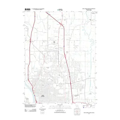
2012 Map of Saint Joseph North
USGS Topo · Published 2012About this map
The Missouri River flows along the western edge of Saint Joseph, framing a dense urban grid that transitions into the Northwestern Loess Hills to the north. This modern survey illustrates the expansive reach of the city into the surrounding hills, where residential growth has reached Country Club Village and the rural crossroads of Avenue City. The landscape is notable for its numerous burial grounds, ranging from the historic Mount Mora Cemetery near the city center to the Vanschoiack Cemetery and B'nai Sholem Cemetery further north, providing a detailed record for genealogists and local historians. To the east, the meandering One Hundred and Two River and its tributary, Long Branch, define the low-lying drainage patterns outside the municipal boundaries. Educational and recreational landmarks such as the Missouri Western State University Western Campus and Moila Golf Course anchor the city's suburban expansion during the early twenty-first century.
Find a feature on this map
132 named features on this map. Tap any name to fly to it.
Don’t see what you’re looking for? This feature index may not catch every label — zoom into the map to look around manually.
Map Details
Editions of this 2012 Saint Joseph North Map
This is the sole edition of this map. No revisions or reprints were ever made.
Other maps of this area

1923 · Clarksdale
USGS Topo · 1:62,500

1924 · St. Joseph
USGS Topo · 1:62,500

1925 · Gower
USGS Topo · 1:62,500

1925 · Clarksdale
USGS Topo · 1:62,500

1926 · Saint Joseph
USGS Topo · 1:62,500

1927 · Dearborn
USGS Topo · 1:62,500

1950 · Kansas City
USGS Topo · 1:250,000

1954 · Kansas City
USGS Topo · 1:250,000

1956 · Kansas City
USGS Topo · 1:250,000

1960 · Kansas City
USGS Topo · 1:250,000