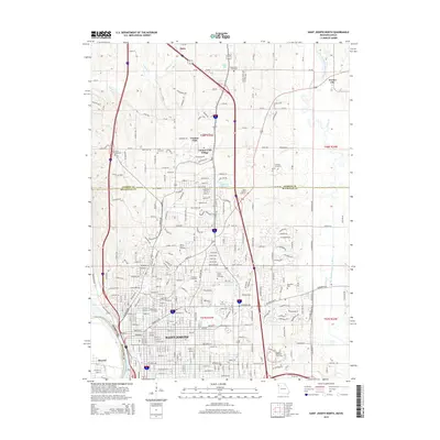
2015 Map of Saint Joseph North
USGS Topo · Published 2015About this map
The Saint Joseph urban grid dominates this northern quadrangle, showing the city's expansion toward the Andrew Co Buchanan Co line. A remarkable concentration of historic burial grounds, including the large Mount Mora Cemetery and Ashland Cemetery, provides a significant resource for genealogists and local historians. To the north, the landscape shifts from dense city blocks to the planned residential areas of Country Club Village and the waters of Lakeland Estates Lake, illustrating the post-war suburban migration patterns of Buchanan County.
Find a feature on this map
267 named features on this map. Tap any name to fly to it.
Don’t see what you’re looking for? This feature index may not catch every label — zoom into the map to look around manually.
Map Details
Editions of this 2015 Saint Joseph North Map
This is the sole edition of this map. No revisions or reprints were ever made.
Other maps of this area

1923 · Clarksdale
USGS Topo · 1:62,500

1924 · St. Joseph
USGS Topo · 1:62,500

1925 · Gower
USGS Topo · 1:62,500

1925 · Clarksdale
USGS Topo · 1:62,500

1926 · Saint Joseph
USGS Topo · 1:62,500

1927 · Dearborn
USGS Topo · 1:62,500

1950 · Kansas City
USGS Topo · 1:250,000

1954 · Kansas City
USGS Topo · 1:250,000

1956 · Kansas City
USGS Topo · 1:250,000

1960 · Kansas City
USGS Topo · 1:250,000