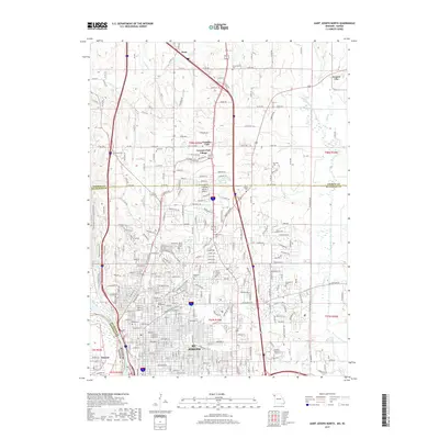
2017 Map of Saint Joseph North
USGS Topo · Published 2017About this map
St. Joseph is the urban anchor of this map, revealing a dense grid of streets and institutional landmarks north of the city center. The landscape transitions from the developed neighborhoods and campuses of Missouri Western State Univ and Vatterott Coll into the hills of the Sunbridge Hills Conservation Area and Krug Park. A notable concentration of cemeteries, including Mount Mora Cem, Mount Olivet Cem, and the historic B'nai Sholem Cem, provides significant detail for genealogists and local historians tracking family sites across the northern reach of the city.
Find a feature on this map
285 named features on this map. Tap any name to fly to it.
Don’t see what you’re looking for? This feature index may not catch every label — zoom into the map to look around manually.
Map Details
Editions of this 2017 Saint Joseph North Map
This is the sole edition of this map. No revisions or reprints were ever made.
Other maps of this area

1923 · Clarksdale
USGS Topo · 1:62,500

1924 · St. Joseph
USGS Topo · 1:62,500

1925 · Gower
USGS Topo · 1:62,500

1925 · Clarksdale
USGS Topo · 1:62,500

1926 · Saint Joseph
USGS Topo · 1:62,500

1927 · Dearborn
USGS Topo · 1:62,500

1950 · Kansas City
USGS Topo · 1:250,000

1954 · Kansas City
USGS Topo · 1:250,000

1956 · Kansas City
USGS Topo · 1:250,000

1960 · Kansas City
USGS Topo · 1:250,000