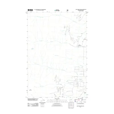
2011 Map of Saint Mary Peak
USGS Topo · Published 2011About this map
Saint Mary Peak anchors the southwest corner of this Bitterroot landscape, overseeing a complex network of high-altitude drainages and canyons. The geography is defined by parallel eastward-flowing waters, including Sweeney Creek, Bass Creek, and Kootenai Creek, which have carved deep paths toward the valley floor. Near the base of these mountains, the modern 21st-century road and trail network reflects a transition from wilderness to recreation and residential pockets. High-elevation features like Lappi Lake and the dramatic relief of Million Gulch stand in contrast to the developed amenities at the Charles Waters Memorial Campground and Larry Creek Campground. The presence of the Larry Creek Loop and roads such as N Kootenai Creek Rd and S Kootenai Creek Rd illustrates the area's accessibility for outdoor enthusiasts and local residents during this period.
Find a feature on this map
26 named features on this map. Tap any name to fly to it.
Don’t see what you’re looking for? This feature index may not catch every label — zoom into the map to look around manually.
Map Details
Editions of this 2011 Saint Mary Peak Map
This is the sole edition of this map. No revisions or reprints were ever made.
Other maps of this area

1901 · Hamilton
USGS Topo · 1:125,000

1912 · Missoula
USGS Topo · 1:125,000

1956 · Hamilton
USGS Topo · 1:250,000

1959 · Hamilton
USGS Topo · 1:250,000

1960 · Hamilton
USGS Topo · 1:250,000

1964 · Hamilton
USGS Topo · 1:250,000

1964 · Dick Creek
USGS Topo · 1:24,000

1964 · St. Joseph Peak
USGS Topo · 1:24,000
1966 · Gash Point
USGS Topo · 1:24,000
1967 · Carlton Lake
USGS Topo · 1:24,000