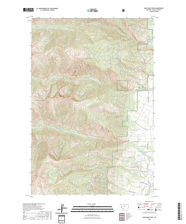
2024 Map of Saint Mary Peak
USGS Topo · Published 2024About this map
Saint Mary Peak serves as the focal point of this mountainous region, standing at the edge of the Selway-Bitterroot Wilderness and the Bitterroot National Forest. The landscape is defined by the high ridges of the Bitterroot Mountains and deeply incised drainages including Kootenai Creek, Bass Creek, and Sweeney Creek. The presence of Bass School Rd and Saint Marys Peak Rd along the eastern margin indicates the transition from the steep wilderness slopes to the more settled foothills of the Bitterroot Valley. This topographical study maps a complex network of forest access points like the Larry Creek Loop and Sweeney Creek Trl, which provide entry into the high-altitude terrain near Lappi Lake. The various trail systems, including the St Mary Peak Trl, illustrate the managed balance between public recreation and the preservation of this protected mountain environment.
Find a feature on this map
54 named features on this map. Tap any name to fly to it.
Don’t see what you’re looking for? This feature index may not catch every label — zoom into the map to look around manually.
Map Details
Editions of this 2024 Saint Mary Peak Map
This is the sole edition of this map. No revisions or reprints were ever made.
Other maps of this area

1901 · Hamilton
USGS Topo · 1:125,000

1912 · Missoula
USGS Topo · 1:125,000

1956 · Hamilton
USGS Topo · 1:250,000

1959 · Hamilton
USGS Topo · 1:250,000

1960 · Hamilton
USGS Topo · 1:250,000

1964 · Hamilton
USGS Topo · 1:250,000

1964 · Dick Creek
USGS Topo · 1:24,000

1964 · St. Joseph Peak
USGS Topo · 1:24,000
1966 · Gash Point
USGS Topo · 1:24,000
1967 · Carlton Lake
USGS Topo · 1:24,000