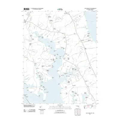
2011 Map of Saint Marys City
USGS Topo · Published 2011About this map
Saint Marys City and the historic Tidewater landscape along the Saint Marys River define this coastal Maryland quadrangle. This 2011 survey illustrates a region where colonial heritage and modern infrastructure coexist, featuring landmarks like Snow Hill Manor and Clockers Fancy. The map records the complex shoreline of the Chesapeake Bay and the Potomac River, detailed by numerous points and coves such as Chancellor Point, Priests Point, and Tarkill Cove.
Find a feature on this map
214 named features on this map. Tap any name to fly to it.
Don’t see what you’re looking for? This feature index may not catch every label — zoom into the map to look around manually.
Map Details
Editions of this 2011 Saint Marys City Map
This is the sole edition of this map. No revisions or reprints were ever made.
Other maps of this area

1892 · Leonardtown
USGS Topo · 1:62,500

1892 · Drum Point
USGS Topo · 1:62,500

1892 · Piney Point
USGS Topo · 1:62,500

1894 · Piney Point
USGS Topo · 1:62,500

1894 · Point Lookout
USGS Topo · 1:62,500

1895 · Leonardtown
USGS Topo · 1:62,500

1895 · Nomini
USGS Topo · 1:125,000

1895 · Piney Point
USGS Topo · 1:62,500

1898 · Nomini
USGS Topo · 1:125,000

1898 · St. Marys
USGS Topo · 1:125,000