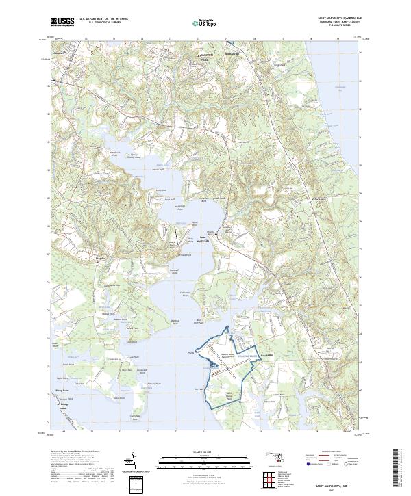
2023 Map of Saint Marys City
USGS Topo · Published 2023About this map
Saint Marys City and the historic grounds of Saint Mary's College of Maryland sit at the center of this Maryland coastal landscape, where the Potomac River estuary meets a complex network of creeks and points. The map details a shoreline defined by deep indentations like Mill Creek and Church Creek, which sheltered early tobacco ports and colonial settlements. Inland, the modern influence of Lexington Park and the Webster Naval Outlying Field contrasts with traditional landings and family-named landmarks such as Cherry Field Graveyard Point and Jutland Neck. This area, once the seat of early Maryland government, is shown here with its contemporary infrastructure, including Point Lookout Rd and the Saint Mary's Airport, yet it retains the original geography of the Carthagena Flats and the intricate marshlands of Frog Marshes.
Find a feature on this map
84 named features on this map. Tap any name to fly to it.
Don’t see what you’re looking for? This feature index may not catch every label — zoom into the map to look around manually.
Map Details
Editions of this 2023 Saint Marys City Map
This is the sole edition of this map. No revisions or reprints were ever made.
Other maps of this area

1892 · Leonardtown
USGS Topo · 1:62,500

1892 · Drum Point
USGS Topo · 1:62,500

1892 · Piney Point
USGS Topo · 1:62,500

1894 · Piney Point
USGS Topo · 1:62,500

1894 · Point Lookout
USGS Topo · 1:62,500

1895 · Leonardtown
USGS Topo · 1:62,500

1895 · Nomini
USGS Topo · 1:125,000

1895 · Piney Point
USGS Topo · 1:62,500

1898 · Nomini
USGS Topo · 1:125,000

1898 · St. Marys
USGS Topo · 1:125,000