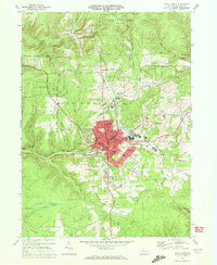
1969 Map of Saint Marys
USGS Topo · Published 1972About this map
Saint Marys and its surrounding borough of Benzinger define this industrial and mountain landscape in the late 1960s. The map captures a significant concentration of religious and community infrastructure, including the historic Decker Chapel, St Marys Ch, and Sacred Heart Ch, alongside the Saint Marys Cemetery. The town's development follows the path of Elk Creek, with industrial activity evidenced by multiple Strip Mines and Gravel Pits on the eastern slopes near Grandview.
Find a feature on this map
46 named features on this map. Tap any name to fly to it.
Don’t see what you’re looking for? This feature index may not catch every label — zoom into the map to look around manually.
Map Details
Editions of this 1969 Saint Marys Map
3 editions found
Other maps of this area

1935 · Mt. Jewett
USGS Topo · 1:48,000

1940 · Mt. Jewett
USGS Topo · 1:62,500

1941 · Benezette
USGS Topo · 1:62,500

1941 · Ridgway
USGS Topo · 1:62,500

1943 · Benezette
USGS Topo · 1:62,500

1944 · Ridgway
USGS Topo · 1:62,500

1948 · Crosby
USGS Topo · 1:62,500

1948 · Wildwood Fire Tower
USGS Topo · 1:24,000
1950 · Wildwood Fire Tower
USGS Topo · 1:24,000

1957 · Warren
USGS Topo · 1:250,000