2015 Map of Saint Olaf
USGS Topo · Published 2015About this map
Saint Olaf serves as the central hub of this northeast Iowa landscape, situated amidst the dissected uplands of Clayton County. The terrain is defined by a dense network of dendritic drainages, including Silver Cr and Roberts Cr, which carve their way toward the prominent Turkey River flowing across the southern portion of the sheet. This area is notably rich for genealogical research, containing a high density of family-named burial grounds. Significant sites such as Johanningmeier Cem, Weymouth Cem, and Patterson Cem are clustered west of the town center, while the United Brethren Cem and Norway Cem are located to the north and west. The settlement pattern follows the ridgelines, with Big Springs Rd and Chariot Rd connecting the scattered farmsteads and agricultural plots that dominate the township geography.
Find a feature on this map
40 named features on this map. Tap any name to fly to it.
Don’t see what you’re looking for? This feature index may not catch every label — zoom into the map to look around manually.
Map Details
Editions of this 2015 Saint Olaf Map
This is the sole edition of this map. No revisions or reprints were ever made.
Other maps of this area

1901 · Oelwein
USGS Topo · 1:125,000

1902 · Elkader
USGS Topo · 1:125,000

1903 · Waukon
USGS Topo · 1:125,000

1906 · Decorah
USGS Topo · 1:125,000

1958 · La Crosse
USGS Topo · 1:250,000

1959 · Dubuque
USGS Topo · 1:250,000

1961 · Dubuque
USGS Topo · 1:250,000

1961 · La Crosse
USGS Topo · 1:250,000

1962 · Dubuque
USGS Topo · 1:250,000
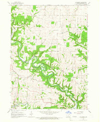
1964 · Littleport
USGS Topo · 1:24,000