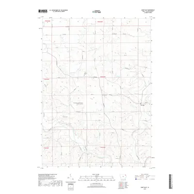
2018 Map of Saint Olaf
USGS Topo · Published 2018About this map
The town of St. Olaf is the primary settlement on this Clayton County landscape, positioned along a network of county roads that traverse the rolling Iowa countryside. The terrain is deeply defined by a complex drainage system, where Roberts Cr and Silver Cr carve through the land before reaching the Turkey River in the south. This area is notable for its concentration of small family and community burial grounds, which offer a high level of detail for local genealogical research. Sites such as Johanningmeier Cem, Weymouth Cem, and Patterson Cem are clustered together, suggesting a dense history of early family homesteads. The presence of the United Brethren Cem and Norway Cem further underscores the cultural and religious foundations of the early pioneers who established these rural communities near Big Spring.
Find a feature on this map
47 named features on this map. Tap any name to fly to it.
Don’t see what you’re looking for? This feature index may not catch every label — zoom into the map to look around manually.
Map Details
Editions of this 2018 Saint Olaf Map
This is the sole edition of this map. No revisions or reprints were ever made.
Other maps of this area

1901 · Oelwein
USGS Topo · 1:125,000

1902 · Elkader
USGS Topo · 1:125,000

1903 · Waukon
USGS Topo · 1:125,000

1906 · Decorah
USGS Topo · 1:125,000

1958 · La Crosse
USGS Topo · 1:250,000

1959 · Dubuque
USGS Topo · 1:250,000

1961 · Dubuque
USGS Topo · 1:250,000

1961 · La Crosse
USGS Topo · 1:250,000

1962 · Dubuque
USGS Topo · 1:250,000
1964 · Littleport
USGS Topo · 1:24,000