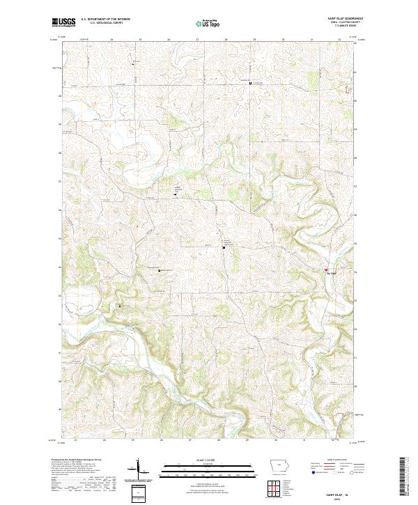
2022 Map of Saint Olaf
USGS Topo · Published 2022About this map
The Turkey River and its winding tributaries, including Roberts Cr and Howard Cr, carve through this section of Clayton County, defining a landscape of deep valleys and plateaued farmland. The town of St. Olaf sits near the eastern edge, serving as a focal point in a rural network of county highways and gravel roads. This area is exceptionally detailed for genealogists, as it preserves the locations of numerous family and township burial grounds, such as Weymouth Cem, Patterson Cem, and the Wagner Township Cem.
Find a feature on this map
55 named features on this map. Tap any name to fly to it.
Don’t see what you’re looking for? This feature index may not catch every label — zoom into the map to look around manually.
Map Details
Editions of this 2022 Saint Olaf Map
This is the sole edition of this map. No revisions or reprints were ever made.
Other maps of this area

1901 · Oelwein
USGS Topo · 1:125,000

1902 · Elkader
USGS Topo · 1:125,000

1903 · Waukon
USGS Topo · 1:125,000

1906 · Decorah
USGS Topo · 1:125,000

1958 · La Crosse
USGS Topo · 1:250,000

1959 · Dubuque
USGS Topo · 1:250,000

1961 · Dubuque
USGS Topo · 1:250,000

1961 · La Crosse
USGS Topo · 1:250,000

1962 · Dubuque
USGS Topo · 1:250,000
1964 · Littleport
USGS Topo · 1:24,000