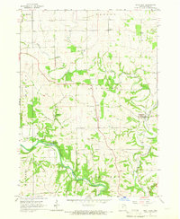
1965 Map of Saint Olaf
USGS Topo · Published 1966About this map
Saint Olaf serves as the primary settlement on this mid-1960s Clayton County landscape, where the Chicago Milwaukee St Paul and Pacific railroad tracks trace a winding path through the eastern valley. The terrain is defined by the deeply etched drainages of Silver Creek and Roberts Creek, which flow toward the southern boundary. Along the Turkey River in the southwest corner, the presence of the Fish Hatchery and Big Spring indicates the specialized use of the local water resources, complemented by the nearby Frieden Park.
Find a feature on this map
22 named features on this map. Tap any name to fly to it.
Don’t see what you’re looking for? This feature index may not catch every label — zoom into the map to look around manually.
Map Details
Editions of this 1965 Saint Olaf Map
This is the sole edition of this map. No revisions or reprints were ever made.
Other maps of this area

1901 · Oelwein
USGS Topo · 1:125,000

1902 · Elkader
USGS Topo · 1:125,000

1903 · Waukon
USGS Topo · 1:125,000

1906 · Decorah
USGS Topo · 1:125,000

1958 · La Crosse
USGS Topo · 1:250,000

1959 · Dubuque
USGS Topo · 1:250,000

1961 · Dubuque
USGS Topo · 1:250,000

1961 · La Crosse
USGS Topo · 1:250,000

1962 · Dubuque
USGS Topo · 1:250,000
1964 · Littleport
USGS Topo · 1:24,000