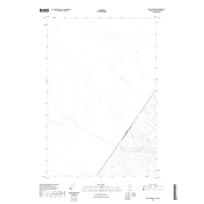
2021 Map of Saint Pamphile
USGS Topo · Published 2021About this map
The international boundary between Canada and the United States of America bisects this remote forest landscape, defining the northern edge of Aroostook County. This 2021 topographic record reveals the watershed of the Big Black River, which flows through the southwestern portion of the map, fed by smaller tributaries like Good Brook. Unlike many developed regions, the area is characterized by a high concentration of wetlands and intricate drainages, notably Saint Amants Brook, which winds through the northeastern quadrant. The presence of Depot Rd provides the primary terrestrial access across the southern hills, where elevations climb as the terrain shifts away from the river valley. The map documents a sparsely populated borderland where commercial logging routes and natural watercourses dictate the human geography of the Maine-Quebec line.
Find a feature on this map
5 named features on this map. Tap any name to fly to it.
Don’t see what you’re looking for? This feature index may not catch every label — zoom into the map to look around manually.
Map Details
Editions of this 2021 Saint Pamphile Map
This is the sole edition of this map. No revisions or reprints were ever made.
Other maps of this area

1954 · Presque Isle
USGS Topo · 1:250,000

1955 · Little East Lake
USGS Topo · 1:62,500

1955 · Depot Lake
USGS Topo · 1:62,500

1955 · Seven Islands
USGS Topo · 1:62,500

1958 · Presque Isle
USGS Topo · 1:250,000

1960 · Presque Isle
USGS Topo · 1:250,000

1962 · Edmundston
USGS Topo · 1:250,000

1976 · Depot Lake
USGS Topo · 1:24,000
1976 · St. Pamphile
USGS Topo · 1:24,000
1977 · St. Adalbert
USGS Topo · 1:24,000