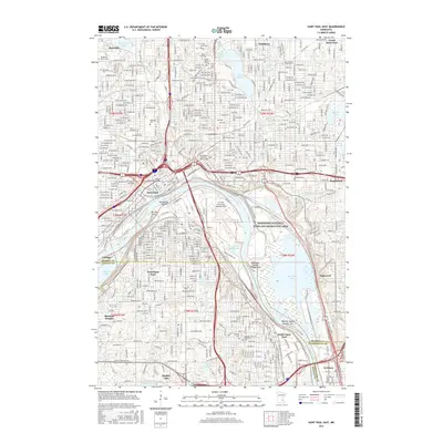
2016 Map of Saint Paul East
USGS Topo · Published 2016About this map
Saint Paul and its eastern suburbs are defined by the sharp bend of the Mississippi River, where the industrial and transport corridors of the 21st century overlap with the city's older residential and spiritual foundations. The map reveals a dense network of memorial sites such as Oakland Cem, Riverview Cem, and Mount Zion Cem, illustrating the diverse genealogical history of Ramsey County. This era shows the developed riverfront anchored by St. Paul Downtown Holman Field and the protected lands of the Mississippi National River and Recreation Area. Educational landmarks like the Metropolitan State Univ - Saint Paul Campus sit just north of the river, while the eastern edge is marked by a series of glacial basins including Lake Phalen and the complex wetlands around Pigs Eye Lake.
Find a feature on this map
246 named features on this map. Tap any name to fly to it.
Don’t see what you’re looking for? This feature index may not catch every label — zoom into the map to look around manually.
Map Details
Editions of this 2016 Saint Paul East Map
This is the sole edition of this map. No revisions or reprints were ever made.
Other maps of this area

1896 · St. Paul
USGS Topo · 1:62,500

1902 · White Bear
USGS Topo · 1:62,500

1946 · Hudson
USGS Topo · 1:62,500

1948 · Stillwater
USGS Topo · 1:62,500

1949 · Hudson
USGS Topo · 1:62,500

1949 · Stillwater
USGS Topo · 1:62,500

1949 · Lake Elmo
USGS Topo · 1:24,000

1950 · Lake Elmo
USGS Topo · 1:24,000

1950 · St Paul Park
USGS Topo · 1:24,000

1951 · St Paul Park
USGS Topo · 1:24,000