
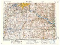
1959 Map of Saint Paul
USGS Topo · Published 1959About this map
The Mississippi River and Minnesota River confluence anchors this mid-century portrait of the Twin Cities and the southeastern Minnesota corridor. At this time, the suburban growth of St Louis Park, Richfield, and Bloomington is clearly defined, while aviation infrastructure like Wold-Chamberlain Field and the U S Naval Air Station mark the era's regional importance. The landscape transitions from the urban density of Saint Paul and Minneapolis into the fertile river valleys and agricultural lands of Dakota and Rice Counties.
Find a feature on this map
99 named features on this map. Tap any name to fly to it.
Don’t see what you’re looking for? This feature index may not catch every label — zoom into the map to look around manually.
Map Details
Editions of this 1959 Saint Paul Map
2 editions found
Other maps of this area

1896 · Minneapolis
USGS Topo · 1:62,500

1896 · St. Paul
USGS Topo · 1:62,500

1901 · Minneapolis
USGS Topo · 1:62,500

1902 · White Bear
USGS Topo · 1:62,500

1902 · Anoka
USGS Topo · 1:62,500

1905 · Minnetonka
USGS Topo · 1:62,500

1907 · Minnetonka
USGS Topo · 1:62,500

1909 · Rockford
USGS Topo · 1:62,500

1929 · Durand
USGS Topo · 1:62,500

1932 · Cochrane
USGS Topo · 1:62,500