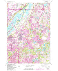
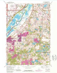
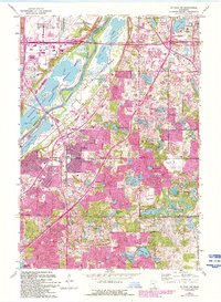
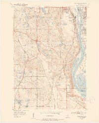
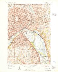
1967 Map of Saint Paul SW
USGS Topo · Published 1993About this map
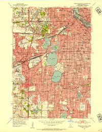
The Minnesota River carves a significant corridor through this landscape, separating the vast Fort Snelling National Cemetery and Minneapolis-St Paul International Airport from the rapidly developing suburbs of Eagan and Mendota Heights. The 1991 revisions highlighted in purple capture a period of intense suburban expansion, including the emergence of the Mall of America at the site of old Metropolitan Stadium.
Find a feature on this map
73 named features on this map. Tap any name to fly to it.
Don’t see what you’re looking for? This feature index may not catch every label — zoom into the map to look around manually.
Map Details
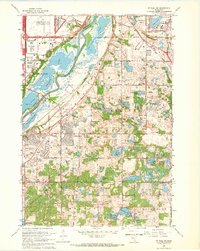
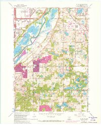
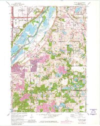
Editions of this 1967 Saint Paul SW Map
6 editions found
Other maps of this area

1896 · Minneapolis
USGS Topo · 1:62,500

1896 · St. Paul
USGS Topo · 1:62,500

1901 · Minneapolis
USGS Topo · 1:62,500

1951 · St. Paul West
USGS Topo · 1:24,000
1951 · Inver Grove
USGS Topo · 1:24,000

1951 · St. Paul SW
USGS Topo · 1:24,000
1951 · St. Paul East
USGS Topo · 1:24,000

1951 · St. Paul
USGS Topo · 1:62,500
1952 · Minneapolis South
USGS Topo · 1:24,000

1953 · Saint Paul
USGS Topo · 1:250,000