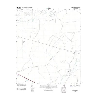
2012 Map of Saint Tammany
USGS Topo · Published 2012About this map
Lacombe Bayou meanders through this portion of St. Tammany Parish, anchoring a landscape where rural development meets established transport corridors. The settlement of Saint Tammany and the nearby Saint Tammany Corner serve as local hubs, connected by a network of named thoroughfares including Peg Keller Rd and Oak Knoll Rd. The presence of the Greater Saint Tammany Airport indicates the area's importance as a regional aviation link, while smaller details like the Crow Cem provide essential data points for genealogists and local historians tracking family lineages in the parish. Drainage patterns are defined by several waterways such as English Br and Double Br, which illustrate the low-lying coastal hydrology characteristic of the region as it appeared in the early 21st century.
Find a feature on this map
57 named features on this map. Tap any name to fly to it.
Don’t see what you’re looking for? This feature index may not catch every label — zoom into the map to look around manually.
Map Details
Editions of this 2012 Saint Tammany Map
This is the sole edition of this map. No revisions or reprints were ever made.
Other maps of this area

1935 · Slidell
USGS Topo · 1:62,500

1935 · Covington
USGS Topo · 1:62,500

1939 · Slidell
USGS Topo · 1:62,500

1939 · Covington
USGS Topo · 1:62,500

1942 · Waldheim
USGS Topo · 1:31,680

1942 · Talisheek
USGS Topo · 1:31,680

1942 · Walkiah Bluff
USGS Topo · 1:31,680

1950 · Slidell
USGS Topo · 1:62,500

1950 · Covington
USGS Topo · 1:62,500

1953 · Mobile
USGS Topo · 1:250,000