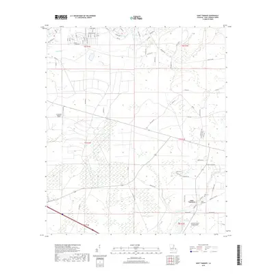
2018 Map of Saint Tammany
USGS Topo · Published 2018About this map
Lacombe Bayou and its drainage network define the low-lying terrain of this St. Tammany Parish landscape, where coastal wetlands like Gum Swamp meet expanding suburban developments. The map reveals a mix of old rural landmarks and modern infrastructure, notably the Northshore Technical Community College Lacombe Campus and the St Tammany Regional Airport. A dense residential street grid in the north, featuring golf-themed names like Bobby Jones Blvd and Niblick St, illustrates the area's transition toward planned communities. Genealogists and local historians can locate early settlement markers near the namesake community of Saint Tammany, including the Peace Grove Cem and Crow Cem situated along the lower reaches of the bayou. This survey provides a precise look at the 2018 interface between the natural drainage of English Br and the evolving road network of the Northshore region.
Find a feature on this map
77 named features on this map. Tap any name to fly to it.
Don’t see what you’re looking for? This feature index may not catch every label — zoom into the map to look around manually.
Map Details
Editions of this 2018 Saint Tammany Map
This is the sole edition of this map. No revisions or reprints were ever made.
Other maps of this area

1935 · Slidell
USGS Topo · 1:62,500

1935 · Covington
USGS Topo · 1:62,500

1939 · Slidell
USGS Topo · 1:62,500

1939 · Covington
USGS Topo · 1:62,500

1942 · Waldheim
USGS Topo · 1:31,680

1942 · Talisheek
USGS Topo · 1:31,680

1942 · Walkiah Bluff
USGS Topo · 1:31,680

1950 · Slidell
USGS Topo · 1:62,500

1950 · Covington
USGS Topo · 1:62,500

1953 · Mobile
USGS Topo · 1:250,000