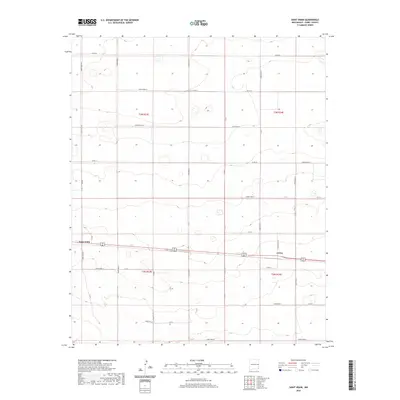
2020 Map of Saint Vrain
USGS Topo · Published 2020About this map
Saint Vrain and Grier serve as the primary focal points of this high plains landscape in Curry County, where the rigid geometry of the Public Land Survey System defines every aspect of the terrain. The map captures a strictly organized agricultural grid, with long straight corridors like Curry Road 15 and Co Rd 16 partitioning the land into regular sections. This network of roads supports a sparse settlement pattern characteristic of eastern New Mexico, where small communities grew along rail and road links.
Find a feature on this map
36 named features on this map. Tap any name to fly to it.
Don’t see what you’re looking for? This feature index may not catch every label — zoom into the map to look around manually.
Map Details
Editions of this 2020 Saint Vrain Map
This is the sole edition of this map. No revisions or reprints were ever made.
Other maps of this area

1954 · Clovis
USGS Topo · 1:250,000

1957 · Portair
USGS Topo · 1:62,500

1957 · Melrose
USGS Topo · 1:62,500

1957 · Hammond Ranch
USGS Topo · 1:62,500

1958 · Clovis
USGS Topo · 1:250,000

1972 · Melrose East
USGS Topo · 1:24,000

1973 · Field SE
USGS Topo · 1:24,000
1973 · Melrose SE
USGS Topo · 1:24,000

1985 · Portair
USGS Topo · 1:24,000
1985 · Garrett Ranch
USGS Topo · 1:24,000