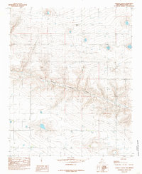
1985 Map of Garrett Ranch
USGS Topo · Published 1985About this map
Garrett Ranch serves as the namesake landmark for this portion of the High Plains in eastern New Mexico, where the landscape is defined by the ephemeral drainage of Running Water Draw. During the mid-1980s, this area of Curry County reflected a highly managed agricultural environment, evidenced by the numerous marked Wells and an industrial Feedlot in the southeast. The terrain is characterized by broad, subtle depressions and the infrastructure of modern ranching and utility transport, including a prominent Substation and a diagonal Pipeline. This document provides a record of land use and water management in a region where seasonal watercourses like Running Water Draw shape the topography and placement of local homesteads.
Find a feature on this map
9 named features on this map. Tap any name to fly to it.
Don’t see what you’re looking for? This feature index may not catch every label — zoom into the map to look around manually.
Map Details
Editions of this 1985 Garrett Ranch Map
This is the sole edition of this map. No revisions or reprints were ever made.
Other maps of this area

1954 · Clovis
USGS Topo · 1:250,000

1957 · Portair
USGS Topo · 1:62,500

1957 · Clovis
USGS Topo · 1:62,500

1957 · Pleasant Hill
USGS Topo · 1:62,500

1957 · Hammond Ranch
USGS Topo · 1:62,500

1958 · Clovis
USGS Topo · 1:250,000

1985 · Portair
USGS Topo · 1:24,000

1985 · Pleasant Hill NW
USGS Topo · 1:24,000

1985 · Smith Ranch
USGS Topo · 1:24,000
1985 · Hammond Ranch SW
USGS Topo · 1:24,000