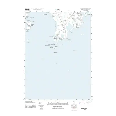
2012 Map of Sakonnet Point
USGS Topo · Published 2012About this map
Sakonnet Harbor and the nearby Sakonnet Light anchor this maritime landscape where the Rhode Island coastline meets the open Atlantic Ocean. The map reveals a peninsula defined by coastal features like Sakonnet Point and the protected waters of Round Pond and Watch House Pond. Settlement patterns are concentrated around Sakonnet and Bahia Corner, with the Sakonnet Golf Course and Middletown Campground highlighting the area's role as a coastal destination.
Find a feature on this map
86 named features on this map. Tap any name to fly to it.
Don’t see what you’re looking for? This feature index may not catch every label — zoom into the map to look around manually.
Map Details
Editions of this 2012 Sakonnet Point Map
This is the sole edition of this map. No revisions or reprints were ever made.
Other maps of this area

1885 · Sakonnet
USGS Topo · 1:62,500

1888 · Fall River
USGS Topo · 1:62,500

1888 · Sakonnet
USGS Topo · 1:62,500

1889 · Newport
USGS Topo · 1:62,500

1890 · Narragansett Bay
USGS Topo · 1:62,500

1892 · Narragansett Bay
USGS Topo · 1:62,500

1893 · Sakonnet
USGS Topo · 1:62,500

1893 · Fall River
USGS Topo · 1:62,500

1894 · Newport
USGS Topo · 1:62,500

1904 · Newport
USGS Topo · 1:62,500