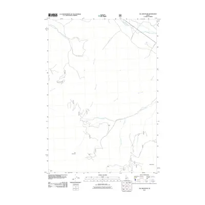
2011 Map of Sal Mountain
USGS Topo · Published 2011About this map
Sal Mountain and the surrounding high country of Lemhi County define this landscape, where early 21st-century topography meets a legacy of mineral extraction. The map records a rugged network of drainage systems feeding toward the Lemhi River in the northeast corner, with several creeks like Mulkey Creek and Baker Creek carving deep paths through the terrain. Evidence of the area's industrial history is found at the Pope Shenon Mine and the Harmony Mine, both situated near the southern and western slopes of the central peaks. Transportation in this part of Idaho is limited to specialized routes such as Salmon Hot Springs Rd and Barracks Ln, alongside numerous Forest Service roads like 5004 and 5030 that provide access to the backcountry.
Find a feature on this map
28 named features on this map. Tap any name to fly to it.
Don’t see what you’re looking for? This feature index may not catch every label — zoom into the map to look around manually.
Map Details
Editions of this 2011 Sal Mountain Map
This is the sole edition of this map. No revisions or reprints were ever made.
Other maps of this area

1950 · Salmon
USGS Topo · 1:62,500

1951 · Salmon
USGS Topo · 1:62,500

1955 · Dubois
USGS Topo · 1:250,000

1955 · Dillon
USGS Topo · 1:250,000

1956 · Goldstone Mtn
USGS Topo · 1:62,500

1956 · Lemhi
USGS Topo · 1:62,500

1957 · Dillon
USGS Topo · 1:250,000

1958 · Dubois
USGS Topo · 1:250,000

1958 · Dillon
USGS Topo · 1:250,000

1962 · Dillon
USGS Topo · 1:250,000