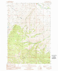
1989 Map of Sal Mountain
USGS Topo · Published 1989About this map
Salmon National Forest dominates this landscape, where mining operations and remote settlements mark the high country of Lemhi County. The mapping shows a significant cluster of industrial activity at the Harmony Mine and its associated adit, along with the Pope-Shenon Mine to the north, suggesting the enduring importance of mineral extraction in this part of Idaho. These sites are linked by a network of 4wd trails that navigate the steep drainages of Sevenmile Creek and Tenmile Creek.
Find a feature on this map
29 named features on this map. Tap any name to fly to it.
Don’t see what you’re looking for? This feature index may not catch every label — zoom into the map to look around manually.
Map Details
Editions of this 1989 Sal Mountain Map
This is the sole edition of this map. No revisions or reprints were ever made.
Other maps of this area

1950 · Salmon
USGS Topo · 1:62,500

1951 · Salmon
USGS Topo · 1:62,500

1955 · Dubois
USGS Topo · 1:250,000

1955 · Dillon
USGS Topo · 1:250,000

1956 · Goldstone Mtn
USGS Topo · 1:62,500

1956 · Lemhi
USGS Topo · 1:62,500

1957 · Dillon
USGS Topo · 1:250,000

1958 · Dubois
USGS Topo · 1:250,000

1958 · Dillon
USGS Topo · 1:250,000

1962 · Dillon
USGS Topo · 1:250,000