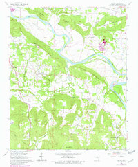
1965 Map of Salado
USGS Topo · Published 1982About this map
White River oxbows and bottomlands dominate this mid-century view of Independence County, where the alluvial plains of Dennison Bottoms meet the rising elevations of Uncle Joe Warren Mountain and Neal Mountain. The landscape is a patchwork of small agricultural settlements and rural gathering places, including the community of Salado and the crossroads at Rosie. Genealogists will find several family-named landmarks and spiritual centers, such as Mt Zion Ch, Swaims Chapel, and the Egner Cem. The transportation network of the era is anchored by the Missouri Pacific railroad line in the north and the winding Old River Road, which follows the contours of the river valley. Numerous gravel pits and quarries scattered across Tucker Ridge indicate the local extraction industries that shaped the terrain during this period of development.
Find a feature on this map
47 named features on this map. Tap any name to fly to it.
Don’t see what you’re looking for? This feature index may not catch every label — zoom into the map to look around manually.
Map Details
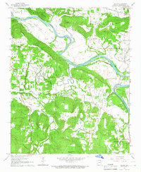
Editions of this 1965 Salado Map
2 editions found
Other maps of this area

1890 · Batesville
USGS Topo · 1:125,000

1891 · Batesville
USGS Topo · 1:125,000

1932 · Strawberry
USGS Topo · 1:62,500

1935 · Strawberry
USGS Topo · 1:62,500

1935 · Newport
USGS Topo · 1:62,500

1941 · Strawberry
USGS Topo · 1:62,500

1942 · Jamestown
USGS Topo · 1:31,680

1942 · Salado
USGS Topo · 1:31,680

1942 · Batesville
USGS Topo · 1:31,680

1943 · Sulphur Rock
USGS Topo · 1:31,680