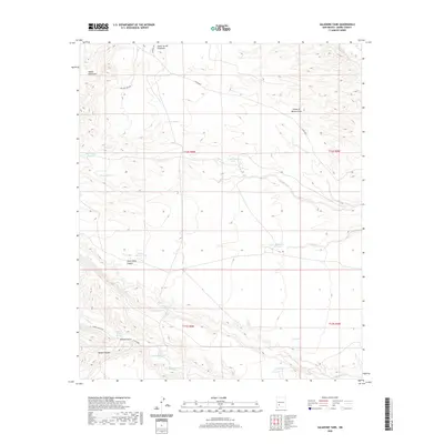
2020 Map of Saladone Tank
USGS Topo · Published 2020About this map
The Salado Mountains dominate the northwestern corner of this Sierra County landscape, where the high desert is defined by an intricate network of drainages and seasonal water catchments. Ranching infrastructure is central to the area's layout, with numerous livestock tanks such as Saladone Tank, School Section Tank, and the CCC Tank providing vital water sources across the arid terrain. The southern portion of the quadrangle is marked by deeper incisions into the earth, including Animas Gulch and Wanda Canyon, which feed into the larger Las Animas Cr system. Named landmarks like Myers Animas Spring suggest the importance of specific water points for local land use. Access is provided by a few established routes like Ladder Ranch Rd and Co Rd B077, which navigate between the steep walls of South Kelly Canyon and the broad reaches of King Arroyo.
Find a feature on this map
29 named features on this map. Tap any name to fly to it.
Don’t see what you’re looking for? This feature index may not catch every label — zoom into the map to look around manually.
Map Details
Editions of this 2020 Saladone Tank Map
This is the sole edition of this map. No revisions or reprints were ever made.
Other maps of this area

1935 · Hillsboro
USGS Topo · 1:48,000

1940 · Hillsboro
USGS Topo · 1:62,500

1954 · Tularosa
USGS Topo · 1:250,000

1955 · Las Cruces
USGS Topo · 1:250,000

1958 · Las Cruces
USGS Topo · 1:250,000

1958 · Tularosa
USGS Topo · 1:250,000

1961 · Skute Stone Arroyo
USGS Topo · 1:24,000

1961 · Saladone Tank
USGS Topo · 1:24,000

1961 · Caballo
USGS Topo · 1:24,000

1961 · Williamsburg NW
USGS Topo · 1:24,000