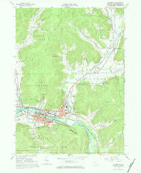
1961 Map of Salamanca
USGS Topo · Published 1971About this map
The Allegheny River corridor serves as the primary artery through this portion of Cattaraugus County, shaping the development of Salamanca and the surrounding valley. In the early 1960s, the landscape is defined by the intersection of the Allegany Indian Reservation and the city's residential grid, where landmarks like Wildwood Cem and Holy Cross Ch sit alongside the busy Erie-Lackawanna and Baltimore and Ohio railroads.
Find a feature on this map
54 named features on this map. Tap any name to fly to it.
Don’t see what you’re looking for? This feature index may not catch every label — zoom into the map to look around manually.
Map Details
Editions of this 1961 Salamanca Map
Other maps of this area

1900 · Salamanca
USGS Topo · 1:62,500

1922 · Randolph
USGS Topo · 1:62,500

1923 · Randolph
USGS Topo · 1:62,500

1923 · Cattaraugus
USGS Topo · 1:62,500

1924 · Ellicottville
USGS Topo · 1:62,500

1938 · Cattaraugus
USGS Topo · 1:62,500

1938 · Salamanca
USGS Topo · 1:62,500

1941 · Cattaraugus
USGS Topo · 1:62,500

1941 · Ellicottville
USGS Topo · 1:62,500

1943 · Randolph
USGS Topo · 1:62,500