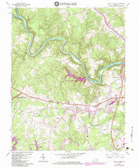
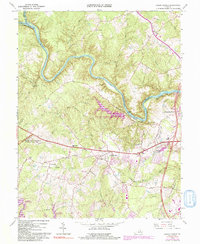
1966 Map of Salem Church
USGS Topo · Published 1984About this map
The Rappahannock River and Rapidan R define the northern boundary of this landscape, where the legacy of the Civil War is etched into the terrain at Fredericksburg-Spotsylvania National Military Park. Military history is visible through features like the Battle Trench and the Old Railroad Grade near Chancellor. The era's industrial heritage is marked by the Spotswood Furnace Ruins along La Rogue Run, while mid-century development is evidenced by the creation of the Motts Run Reservoir and the Ni River Reservoir. Local genealogy and community life are anchored by numerous country churches, including Tabernacle Cem Ch, Mt Zion Ch, and the namesake Salem Ch. Transportation patterns are revealed by the historic Plank Road and the growth around Fivemile Fork and Waverly Village, showing the shift from a rural agricultural and mining landscape toward modern residential expansion.
Find a feature on this map
53 named features on this map. Tap any name to fly to it.
Don’t see what you’re looking for? This feature index may not catch every label — zoom into the map to look around manually.
Map Details
Editions of this 1966 Salem Church Map
5 editions found
Other maps of this area

1887 · Spottsylvania
USGS Topo · 1:125,000

1889 · Fredericksburg
USGS Topo · 1:125,000

1892 · Fredericksburg
USGS Topo · 1:125,000

1892 · Spottsylvania
USGS Topo · 1:125,000

1894 · Fredericksburg
USGS Topo · 1:125,000

1926 · Stafford
USGS Topo · 1:62,500

1931 · Stafford
USGS Topo · 1:62,500

1942 · Guinea
USGS Topo · 1:31,680

1942 · Spotsylania
USGS Topo · 1:31,680

1942 · Brokenburg
USGS Topo · 1:31,680