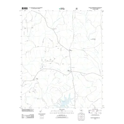
2011 Map of Salem Crossroads
USGS Topo · Published 2011About this map
Salem Crossroads serves as a central junction in this Fairfield County landscape, where rural routes converge amidst a network of historic family and community landmarks. The area is defined by its deep roots, evidenced by several burial sites including the Mobley Cemetery, Feaster Cemetery, and Rock Creek Cemetery. Near the intersection of Fort Wagner Rd and Dupont Ln, the Fort Wagner Monument stands as a notable commemorative site, reflecting the region's layered history.
Find a feature on this map
51 named features on this map. Tap any name to fly to it.
Don’t see what you’re looking for? This feature index may not catch every label — zoom into the map to look around manually.
Map Details
Editions of this 2011 Salem Crossroads Map
This is the sole edition of this map. No revisions or reprints were ever made.
Other maps of this area

1904 · Columbia
USGS Topo · 1:125,000

1941 · Spartanburg
USGS Topo · 1:250,000

1953 · Spartanburg
USGS Topo · 1:250,000

1960 · Spartanburg
USGS Topo · 1:250,000

1963 · Spartanburg
USGS Topo · 1:250,000

1964 · Spartanburg
USGS Topo · 1:250,000

1968 · Blackstock
USGS Topo · 1:24,000

1969 · Lebanon
USGS Topo · 1:24,000

1969 · Pomaria
USGS Topo · 1:24,000

1969 · Blair
USGS Topo · 1:24,000